Cherokee National Forest · Big Frog Wilderness, Tennessee
Big Frog Trail #64 at Cherokee National Forest
Big Frog Trail #64 at Cherokee National Forest: 5.5 mi.
Updated Oct 26, 2026 · Source-verified by TennesseeHikes
- Distance
- 5.5 mi
On this page
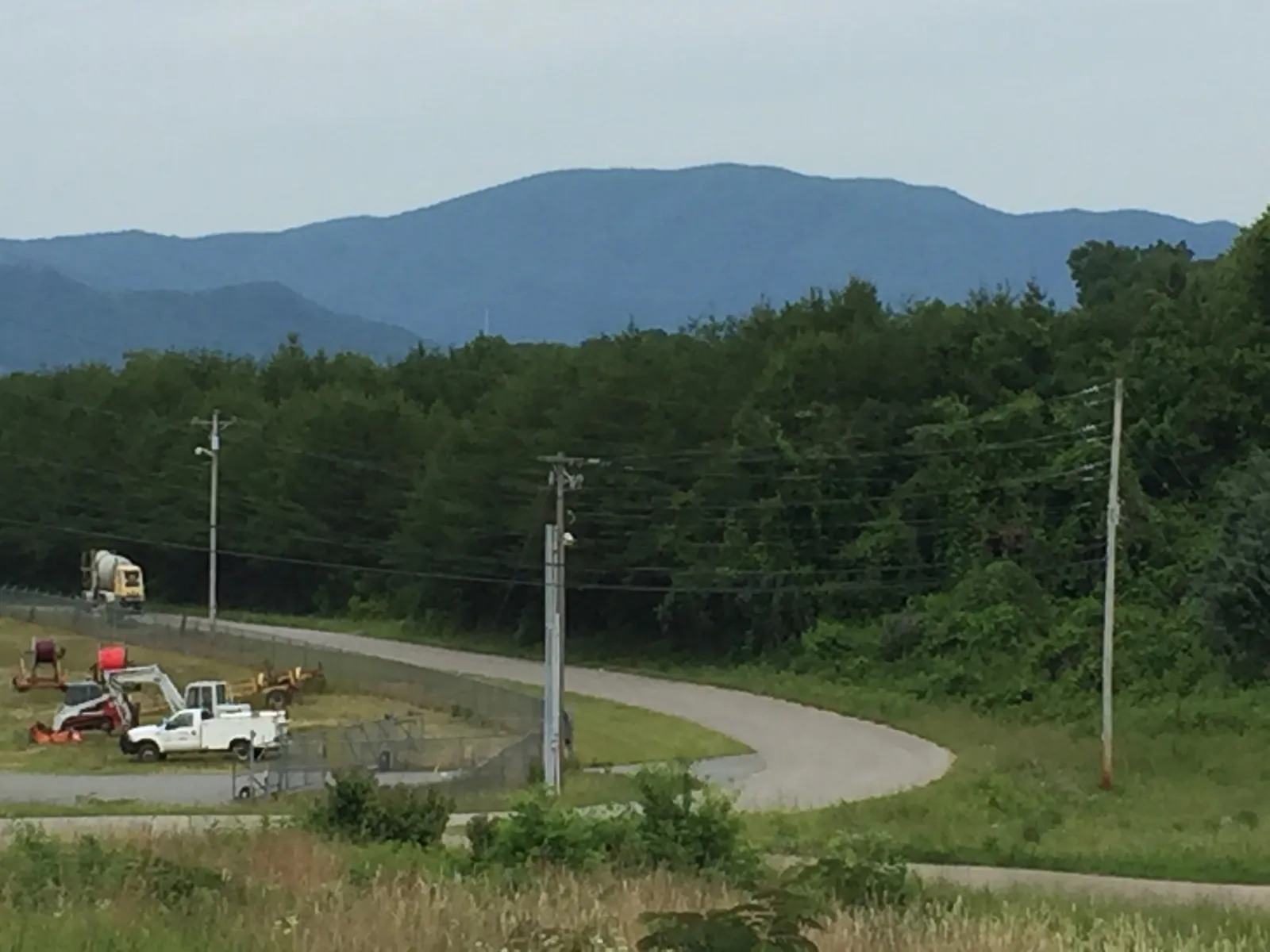
Big Frog Mountain seen from Fannin County, Georgia, in June 2017. Photo by Thomson200 (CC0), via Wikimedia Commons.
Big Frog Trail #64 leads to the top of Big Frog Mountain in Big Frog Wilderness. The Big Frog Mountain page says the steep climb tops out at over 4,000 feet elevation. The mountain is managed as a black bear reserve and is a destination for backpacking, day-hiking, and hunting. About 35 miles of backcountry trails cross the region, some of them climbing above 4,000 feet. Trail #64 is part of the long-distance Benton MacKaye Trail.
Quick facts
- Official length: 5.5 miles, rated moderate, on the Big Frog Backcountry Trail System Map.
- Mapped listing: 3.69 mi on this site, from an OpenStreetMap line. The Forest Service does not print 3.69. Do not average the two numbers.
- High point: over 4,000 feet. Elevation gain is not listed on the Forest Service pages.
- Round trip: not listed. Do not double 5.5 into an official round-trip figure.
- Rules: Wilderness groups are limited to 12 people. No passes or permits are required in the Big Frog Region.
- Blazes: a white diamond on the Benton MacKaye Trail outside wilderness; not blazed at all inside Big Frog Wilderness.
- Not listed on the Forest Service pages: dog rules, water sources, drive times, restrooms, and a hiking time.
Getting There
Main routes on the mountain page are US 64, US 411, TN 68, and Forest Road 221. The nearest towns named there are Copperhill, Tennessee, and McCaysville, Georgia. A turn-by-turn approach, a parking-lot name, a space count, and drive times are not listed on the Forest Service pages.
Trails that reach Big Frog Trail #64:
- Hemptop #145 off Forest Road 62. The map spells it Hemp Top #145, 5.0 miles, rated difficult.
- Wolf Ridge #66 (2.4 miles, moderate) and Big Creek #68 (4.1 miles, moderate), both off Forest Road 221.
- Chestnut Mountain #63 off the Big Frog Loop road. No mileage for #63 is printed on the map list used here.
Forest Roads 62 and 221 have had storm and flood repair closures and detours in 2024-2026. This guide does not state a specific current closure. Read Cherokee National Forest alerts and check with the Ocoee Ranger District before you drive.
The Trail
The official length is 5.5 miles, moderate. This site’s mapped line is 3.69 mi. Keep them separate, and do not average them. No round-trip mileage is listed.
The mountain page’s description is the steep climb to the top of Big Frog Mountain, topping out at over 4,000 feet. The moderate rating and the word “steep” are both printed. Grade, tread, fords, and elevation gain are not listed. The photo shows the forested ridgeline from Fannin County, Georgia, in June 2017. It is not a picture of the tread or a blaze.
The Benton MacKaye Trail runs along parts or all of trails 64, 69, 70, 145, and 303. The map’s lengths for the others are Fork Ridge #69, 1.9 miles, moderate; Rough Creek #70, 2.9 miles, moderate; West Fork #303, 2.2 miles, moderate; and Hemp Top #145, 5.0 miles, difficult. Outside wilderness the Benton MacKaye carries a white diamond. Inside Big Frog Wilderness it is not blazed at all.
Also on that map, and not described as joining #64: Licklog Ridge #65, 5.4 miles, moderate; Grassy Gap #67, 4.5 miles, moderate; Yellow Stand Lead #73, 2.3 miles, moderate. Wolf Ridge #66 and Big Creek #68 are the Forest Road 221 trails named as reaching Trail #64.
Wilderness Rules and Planning
The mountain is a black bear reserve. Published uses are backpacking, day-hiking, and hunting. A season chart, a bear-hunting rule, and a food-storage method are not listed on the Forest Service pages used here. Confirm hunting details with the Ocoee Ranger District.
No passes or permits are required in the Big Frog Region. Group size in the Wilderness is limited to 12. Dog rules, water sources, and restrooms are not listed. Carry the water you will drink.
Nearby, the mountain page lists snorkeling on the Conasauga River along Conasauga River Trail #61, Tumbling Creek Campground, and the Cohutta Wilderness across the Georgia line. Opening dates and a mileage from Trail #64 to those places are not listed.
Tips
Check alerts the morning you leave when Forest Road 62 or Forest Road 221 is the drive. Storm and flood repairs have closed or detoured those roads in 2024-2026.
Plan daylight for a climb the map calls moderate and the mountain page calls steep, with a top over 4,000 feet. No hiking time and no elevation gain are listed. Returning the same way repeats the 5.5-mile official length. That repeat is not a published round trip.
Set the access trail before you need a signal. Cell service is not listed. Inside the wilderness, do not look for a white diamond. That blaze is used outside wilderness only. Keep the group at 12 or fewer, and pack out what you bring.
Sources
- Big Frog Mountain: black bear reserve; backpacking, day-hiking, and hunting; about 35 miles of trails; Trail #64 over 4,000 feet; group size 12; access trails; Benton MacKaye Trail; US 64, US 411, TN 68, Forest Road 221; Copperhill and McCaysville; no passes or permits; Conasauga River Trail #61, Tumbling Creek Campground, Cohutta Wilderness.
- Big Frog Backcountry Trail System Map: #64 is 5.5 miles, moderate. Benton MacKaye on parts or all of 64, 69, 70, 145, and 303; white diamond outside wilderness; not blazed inside Big Frog Wilderness.
- Cherokee National Forest alerts: Forest Roads 62 and 221 have had storm and flood repair closures and detours in 2024-2026. Check before driving.
- This site: mapped 3.69 mi (OpenStreetMap), not an official length.
- Photo: Wikimedia Commons, Thomson200, CC0.
FAQs
How long is Big Frog Trail #64?
5.5 miles, rated moderate. This site’s mapped line is 3.69 mi. Do not average them. No round-trip figure and no elevation gain are listed.
How do you reach the trail?
US 64, US 411, TN 68, and Forest Road 221, near Copperhill, Tennessee, and McCaysville, Georgia. Use Hemptop #145, Wolf Ridge #66, Big Creek #68, or Chestnut Mountain #63, and check alerts before Forest Roads 62 and 221.
Is the trail blazed?
It is part of the Benton MacKaye Trail, along parts or all of trails 64, 69, 70, 145, and 303. A white diamond marks it outside wilderness. Inside Big Frog Wilderness it is not blazed at all.
Do you need a permit? Are dogs or water listed?
No passes or permits are required in the Big Frog Region. Groups in the Wilderness are limited to 12. Dog rules, water sources, and restrooms are not listed on the Forest Service pages.